Point clouds are only as useful as the tools you have to navigate and interpret them. With BricsCAD V25.2, we’ve fine-tuned our point cloud workflows so you can move through scans more intuitively, classify them with greater precision, and see your data the way you need to.
Here’s a look at what’s new.
Bubble Views that Make Sense
In BricsCAD V25.2, navigating through scans is easier thanks to visible scan positions inside the bubble viewer. You can even resize the bubbles for clarity—bumping them up from 200 mm to 500 mm, for example—and use the render settings in the Point Cloud Manager with a new “visible only” option.
Bubble views now give instant visual feedback:
- Green/blue when visible in the scan.
- Red when hidden by parts of the point cloud.
For structured scans, visible bubbles are green and hidden ones are red (just like in model space). For unstructured scans, visible bubbles appear blue. Either way, you can simply double-click to navigate to the next position.
A New Way to “See Through” Scans
We’ve added an X-ray color map that lets you view point clouds in the same way you're used to with other software. Just choose X-ray from the style dropdown in Color Map.
It works especially well in orthographic views, where you can clearly see how different building elements relate. In practice, that means tracing inner walls or snapping rectangles directly to scan points is faster and more precise.

Smarter Classification
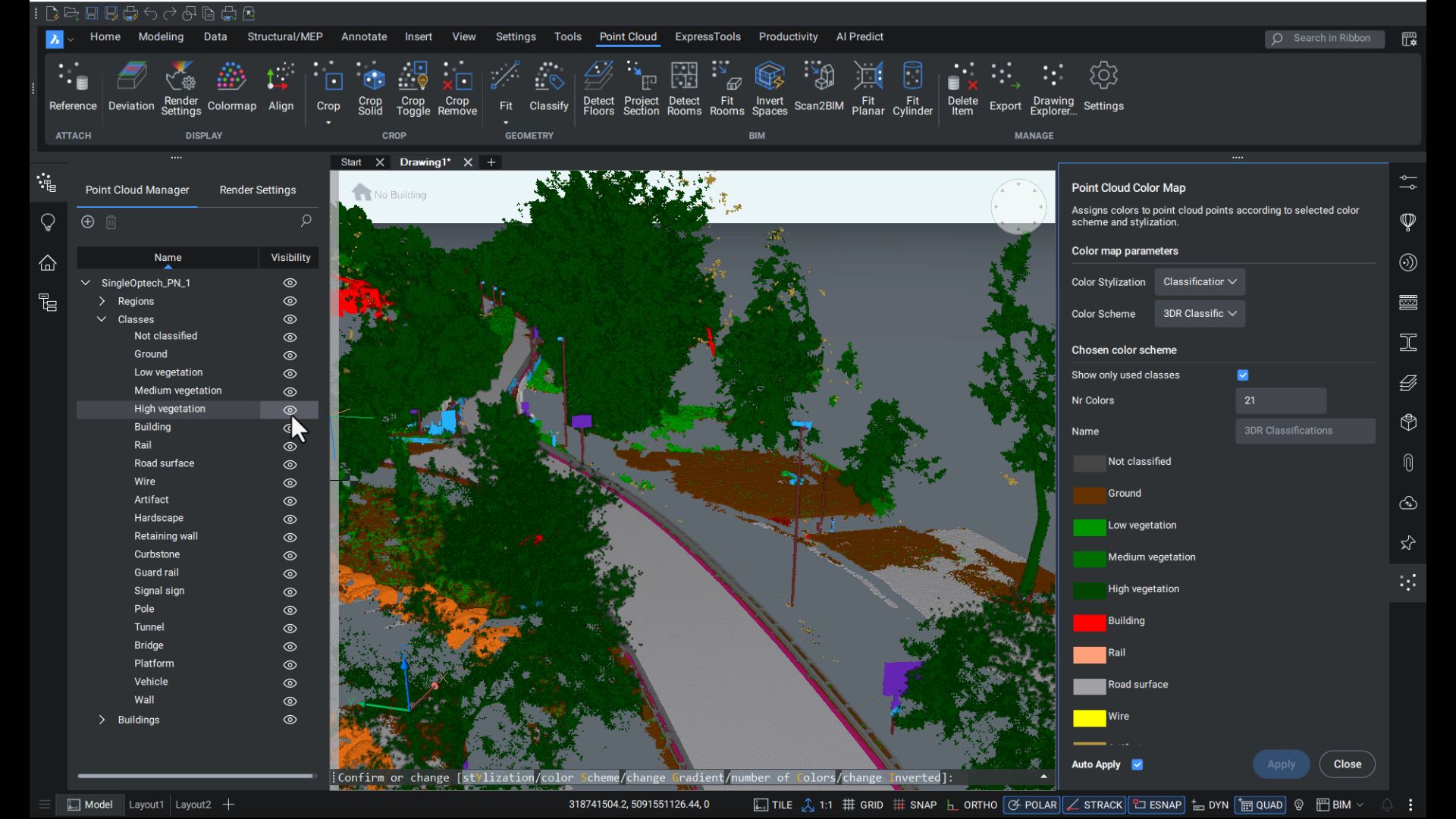
The Point Cloud Classify tool now includes two new models:
- Roads: Tailored for mobile mapping datasets.
- Construction: Ideal for aerial scans.
For Leica users, we’ve also added the familiar Cyclone 3DR color scheme to make working in BricsCAD feel consistent with your existing workflows.

Better Geolocation
When your dataset includes geographic information, BricsCAD will now automatically store it and set the drawing’s GCS (geographic coordinate system). The Properties panel shows the WKT (Well-Known Text) description, and you can toggle geolocation on/off as needed.
This opens the door to using Geomap and Map Connect with point clouds, tying your scans into a bigger geospatial context.

More Than Just Point Clouds
These updates give point cloud users a big boost. And they’re just a small part of what’s new in BricsCAD V25.2. The BricsCAD team has delivered dozens of new and enhanced features designed to make your everyday workflows smoother. Download and experience the difference.


