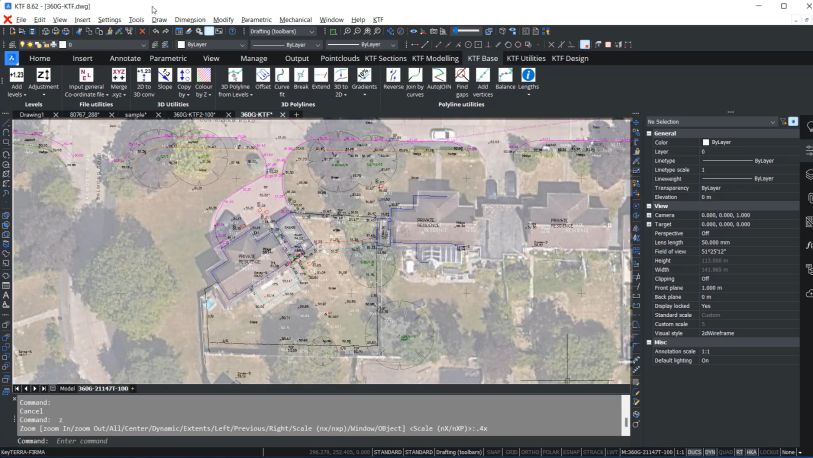
Land Surveyors need to make full use of a project’s 3D CAD model together with their topological data and ground models. With powerful and accurate CAD tools and innovative third-party apps, surveyors can import and process data from a total station site survey with high accuracy, providing extensive deliverables.
The range of deliverables from the site survey data varies considerably depending on a project’s complexity, from generating 3D ground models for excavation plans to bill of quantities for groundwork.
An easy and powerful method to import data from a total station site survey and then create accurate deliverables is by using the third-party apps keyTERRA-FIRMA or Stringer Topo with BricsCAD Pro.
Create accurate site surveys
As a land surveyor, you must gather massive amounts of data to produce an accurate site survey for your clients. This includes topological data from total site survey equipment, such as LiDAR scans or data loggers, and design data from the civil engineer’s 3D CAD model. This could include drawing elements such as maintenance covers, bollards and curb stones, depending on the complexity of the site and project.
An element in the example is a single curved curb. You can easily view the survey coordinates from the survey equipment. Then open the file using keyTERRA-FIRMA, specify or confirm the file format, and use a code look-up table to create point or linear features.
Customize for more accurate CAD deliverables
The table is fully user customizable with codes, layers, and more. If the feature is curved, it can either be coded onsite or at the office as curve fitted. This makes it more accurate.
keyTERRA-FIRMA also allows 3D features to be curve fitted by interpolating 3D points along the implied curve.
The easy way to import topographic data
The power of BricsCAD Pro, along with the powerful design features offered by third-party applications, provides an easier and more optimized way to import topo data into a CAD drawing and create an accurate CAD deliverable
Discover the BricsCAD difference
With BricsCAD, surveyors can reduce costs and drive project efficiency. Our CAD-based platform comes with intelligent commands and tools to accelerate your point-cloud workflow, while our partner apps provide advance survey features.
Discover the BricsCAD difference, and find out more about our Land Surveyor solutions.
To review more tools and features in CAD for your industries and roles, you can explore how to build better workflows with BricsCAD’s interoperable, intuitive and open solutions. We can’t wait for you to join and connect with the Bricsys community.

